Patented Lode Claim

The Red Wing Mine

U.S.M.S. 6286
El Dorado Co., California
Patented March 31, 1949
13.748 acres
The country

The Red Wing sits west of Logtown in El Dorado County, California, in the Big Canyon Mining District, three miles south of the El Dorado railroad station. Logtown — the Gold Rush settlement the ridge takes its name from — sat in the ravine below. A thousand placer miners worked the ravine in its early years, and a half dozen quartz mills ran on the ridge above through the late nineteenth century: the Pocahontas, the La Moille, the Ophir, the Minnehaha, the Empire. The pay ran out, the mills moved on, and Logtown was mostly empty by the early twentieth century. The Red Wing came late to this country. James located it on March 2, 1909, twenty years after Logtown's peak, when the quartz period on the ridge was already winding down.

The early years — 1909 through 1922

W. H. James located the Red Wing lode claim west of Logtown on March 2, 1909, and recorded it with the El Dorado County Recorder in Mining Locations, Book O, page 129. He amended the location on February 2, 1910, and re-amended it on April 3, 1920. The 1920 paper is the first document in the chain that we have on hand.

By the autumn of 1914 James was working in El Dorado County in partnership with P. J. Loveless. The Engineering and Mining Journal of September 26 placed them at the Bumgardner mine, two miles west: they had bought a former producer, put a small mill on it, and recovered the old vein at 150 feet.

A state mineralogist walked the Red Wing in 1917. The report he filed runs five sentences and names everybody: James, Lawyer, and Loveless of El Dorado as owners; W. F. Deaner of San Francisco as bondholder; J. I. Noce as superintendent. Two adits, an upper 125 feet long and a lower crosscut 525 feet long. A six-foot vein in the form of a stringer lead, cut 450 feet from the lower portal. Five men employed. A two-stamp mill standing on the ground.

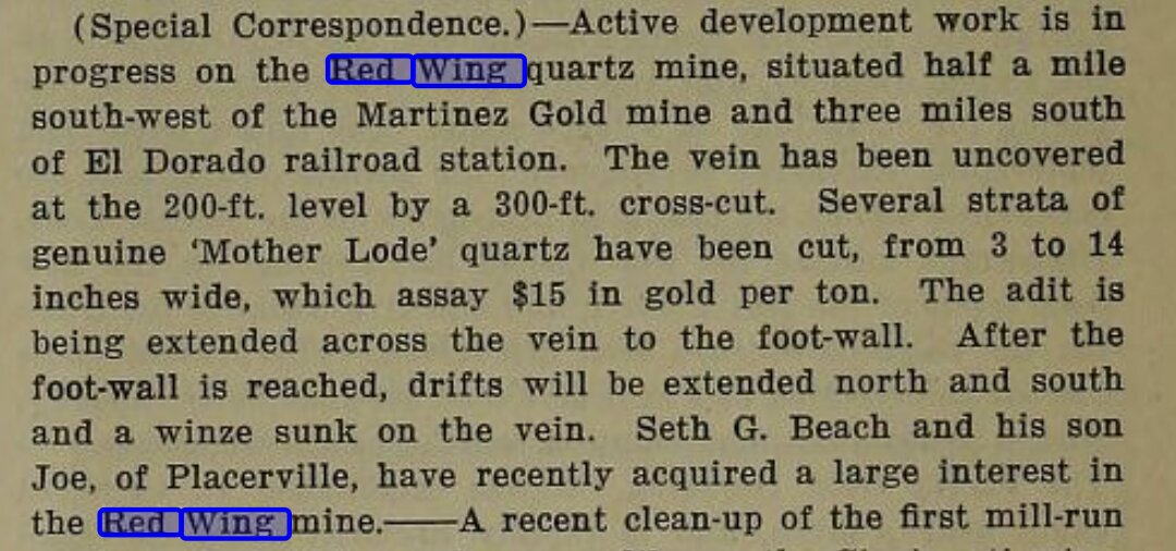
In 1918, Seth G. Beach acquired a large interest. He and his son drove down to a 200-foot level off a 300-foot crosscut, and recovered several strata of Mother Lode quartz three to fourteen inches wide. The trade-press item reporting it reads like the kind of promoter's notice the era produced in volume, and Don is skeptical of Beach's figures. Around 1919, James bought out one of the early interests by quitclaim for about ten dollars, and from then on held the claim in his own name. By 1922 the property was running under Goodwin and Luster, two stamps still going.

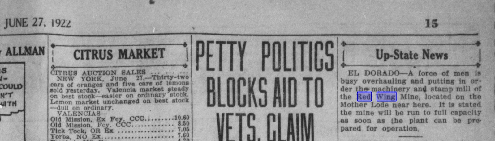
The local press carried the property through these years in short notices. A force of men is busy overhauling the machinery and stamp mill of the Red Wing Mine, located on the Mother Lode near here — Placerville Mountain Democrat, June 27, 1922.

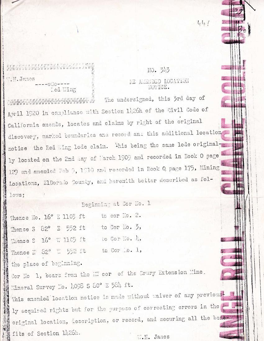
The 1920 re-amended location notice

The oldest paper we hold for the Red Wing is the Re-Amended Location Notice that James filed on April 3, 1920. The first paragraph identifies the lode as the same one he had located on March 2, 1909, and amended in February of 1910. The notice runs the courses and distances at each of the four corners and re-states the right of original discovery. It was recorded with Chas E. Marsh, Recorder of El Dorado County, on April 5, 1920, at fifty minutes past one in the afternoon. Mining Locations, Book U, page 83. Twenty-one years before the federal patent.

James kept a certified copy in his own papers. The endorsed copy was struck again by James W. Sweeney, a later County Recorder, in December of 1941.

Re-Amended Location Notice for the Red Wing lode claim, filed by W. H. James, April 3, 1920.
Re-Amended Location Notice, April 3, 1920. W. H. James, locator. Recorded at the El Dorado County Recorder.
James and the Mint — April 1926 through October 1928

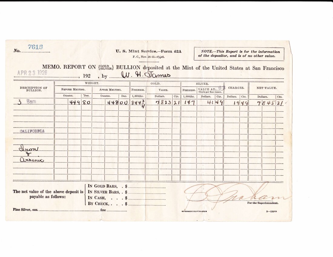
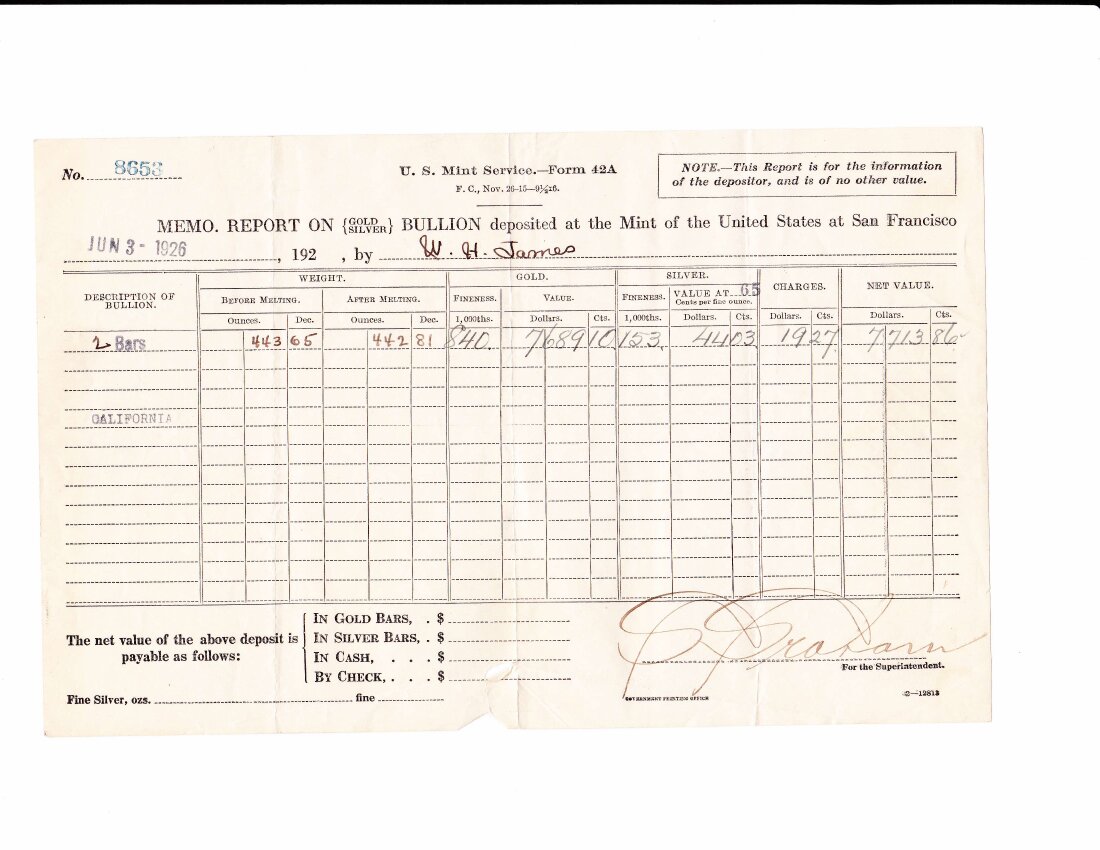
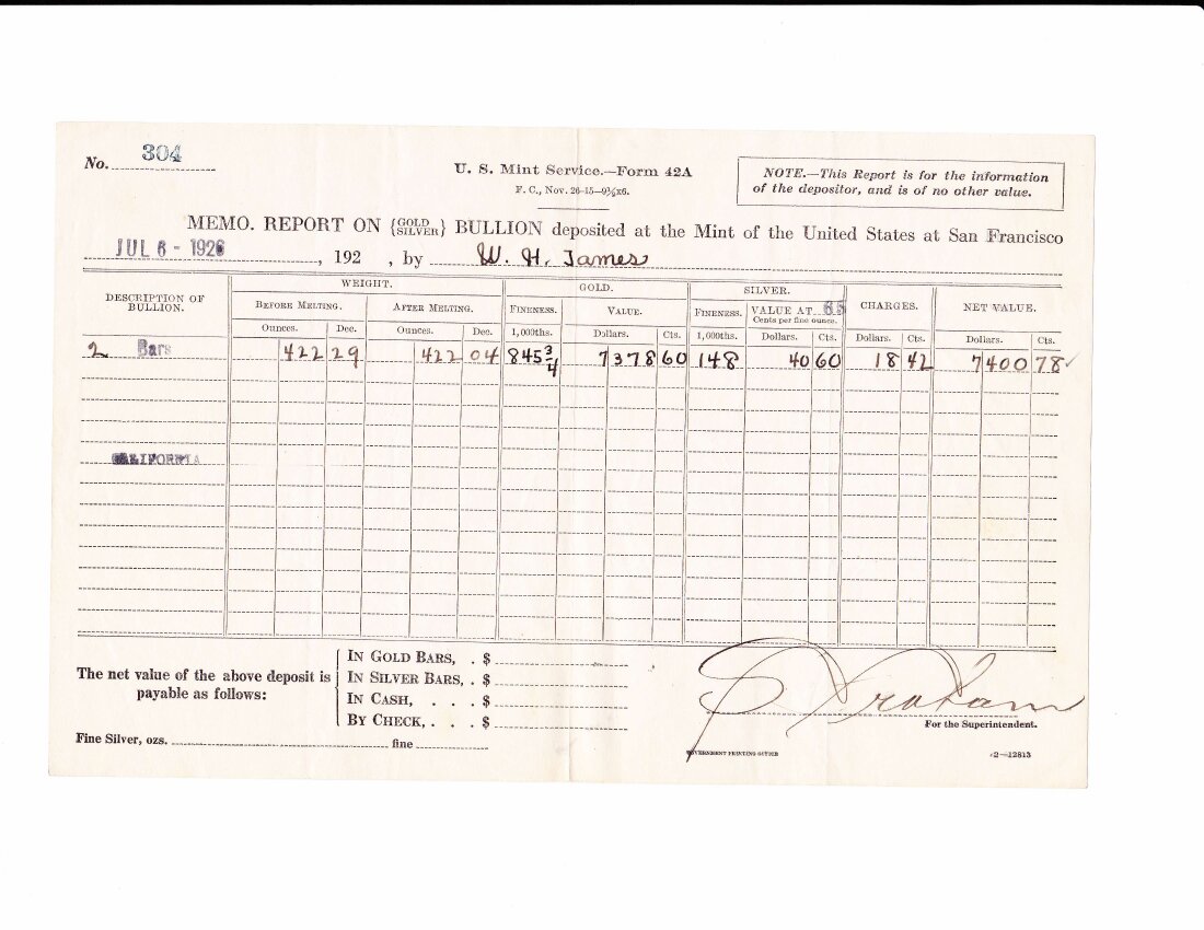
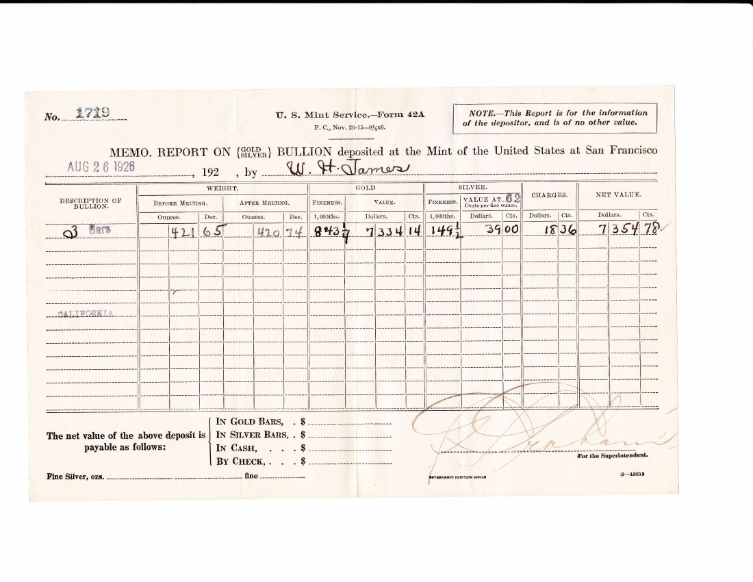
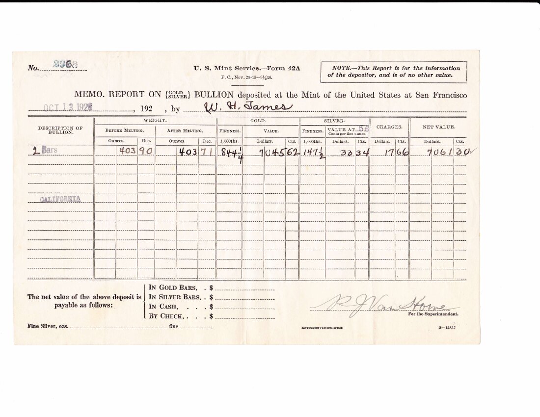
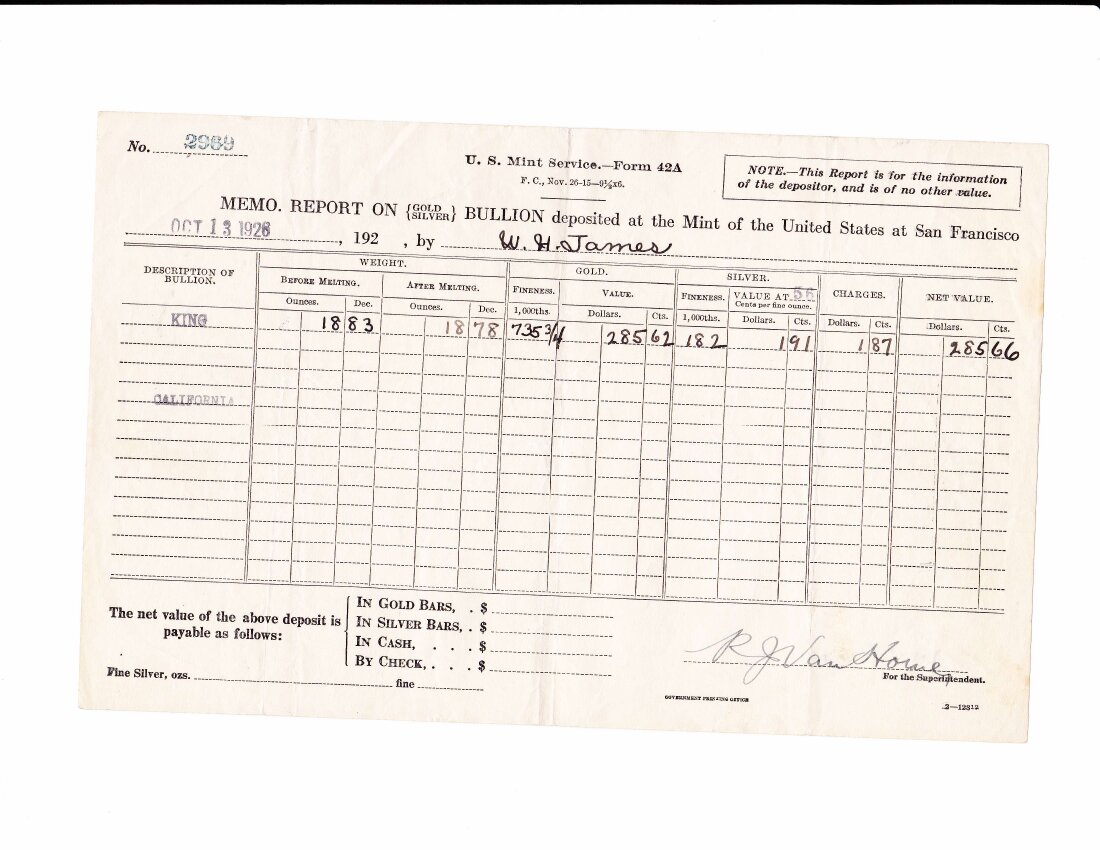
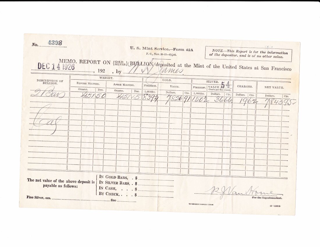
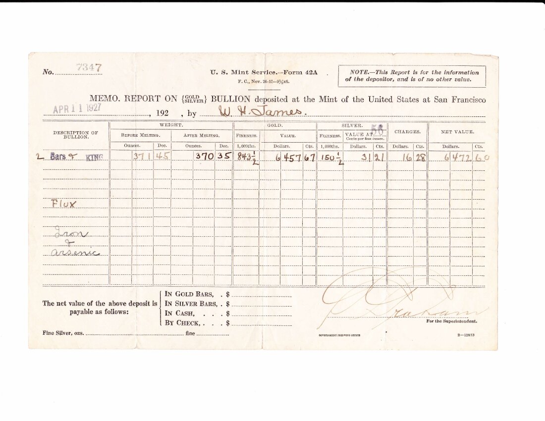
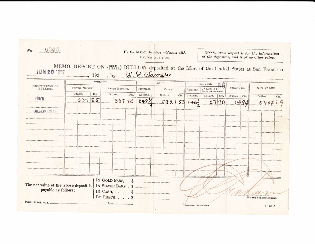
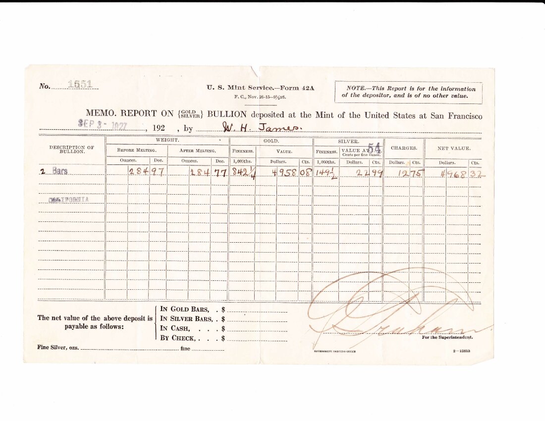
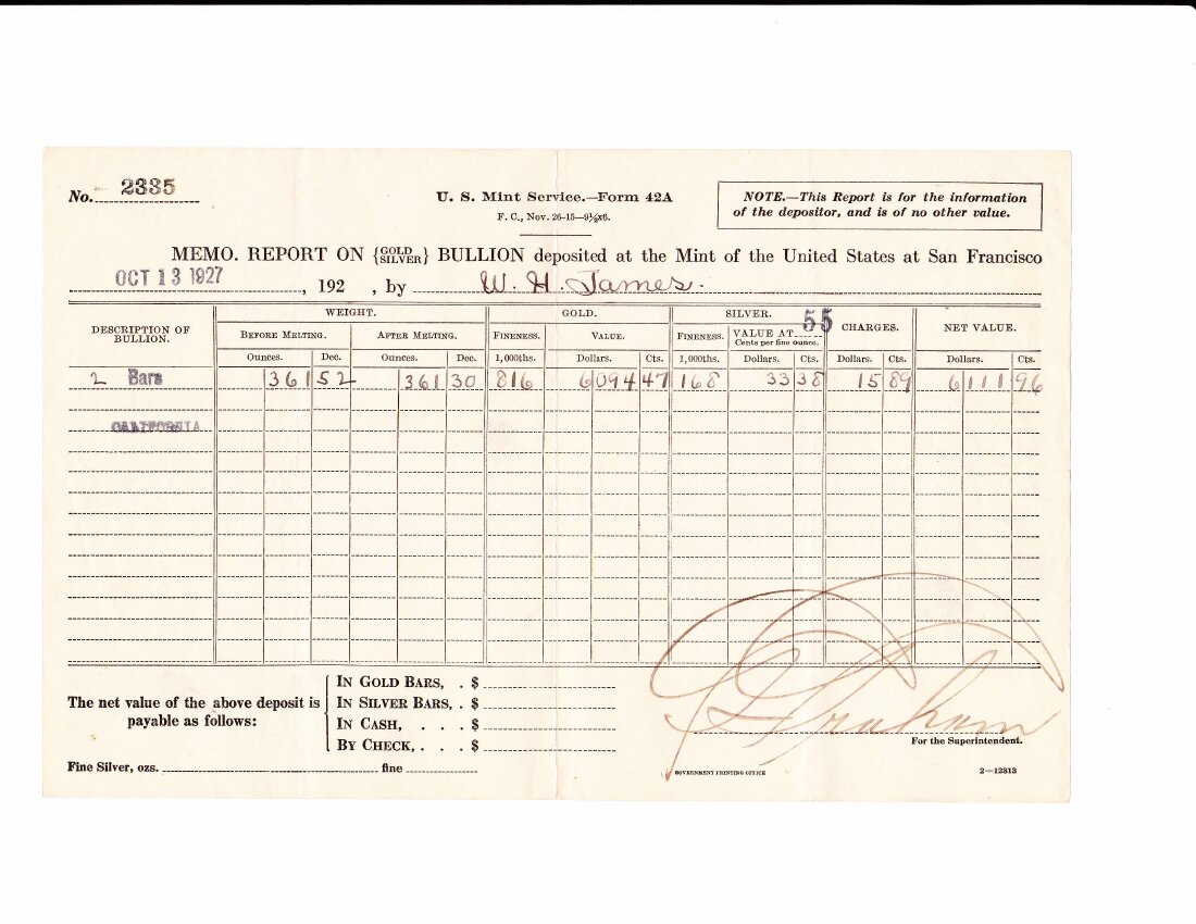
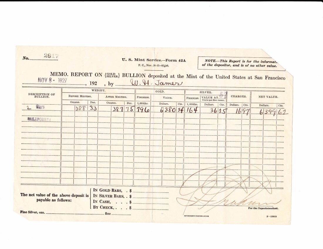
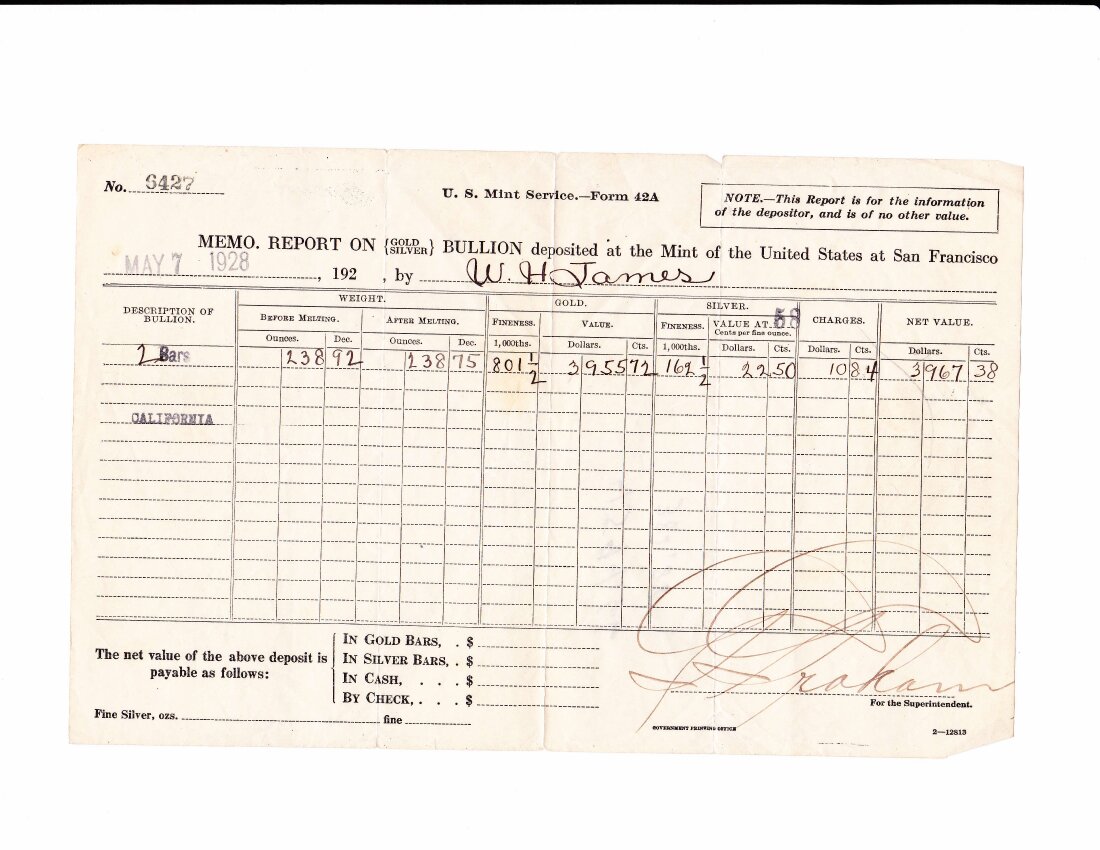
For thirty months, W. H. James walked gold from the Red Wing to the United States Mint at San Francisco. He did it thirteen times. Each trip he carried bars of doré — gold-and-silver alloy from the mill on the property — weighed in at the Mint, melted, assayed for fineness, and paid out by the Treasurer's office.

The receipts are below. The first is April 23, 1926, deposit number 7615: three bars weighing 449.80 ounces before melting, 448.00 after; gold fineness 0.8443; value paid, $7,845.21. The thirteenth is the second of two deposits made on the same day in October of 1928. Across the run, the property delivered about four thousand fine ounces of gold. Each Form 42A is signed in James's handwriting as depositor.

The 1940 assay

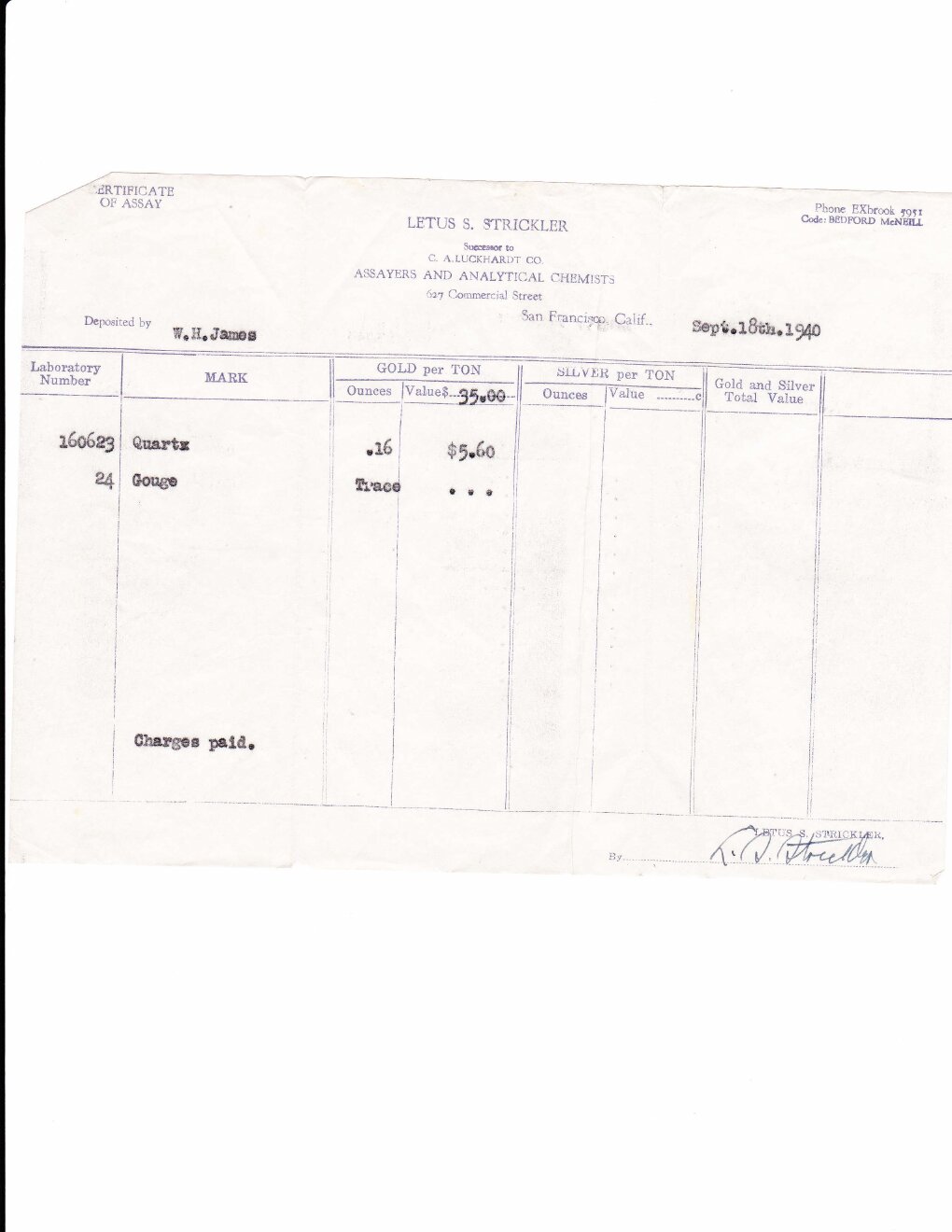
Twelve years after the last Mint receipt, James was still sending samples from the property to be assayed in San Francisco. The certificate below is from Lewis & Wehrlich Smelting and Refining Company, dated September 14, 1940. Depositor: W. H. James. The sample was quartz. The gold ran .15 ounce to the ton, with traces of silver. The charges were paid. He kept it in his files.

1940 assay certificate from Lewis & Wehrlich Smelting and Refining Company, San Francisco. Depositor W. H. James.
Lewis & Wehrlich, San Francisco. September 14, 1940. .15 oz/ton gold on a quartz sample.
The patent — March 31, 1949

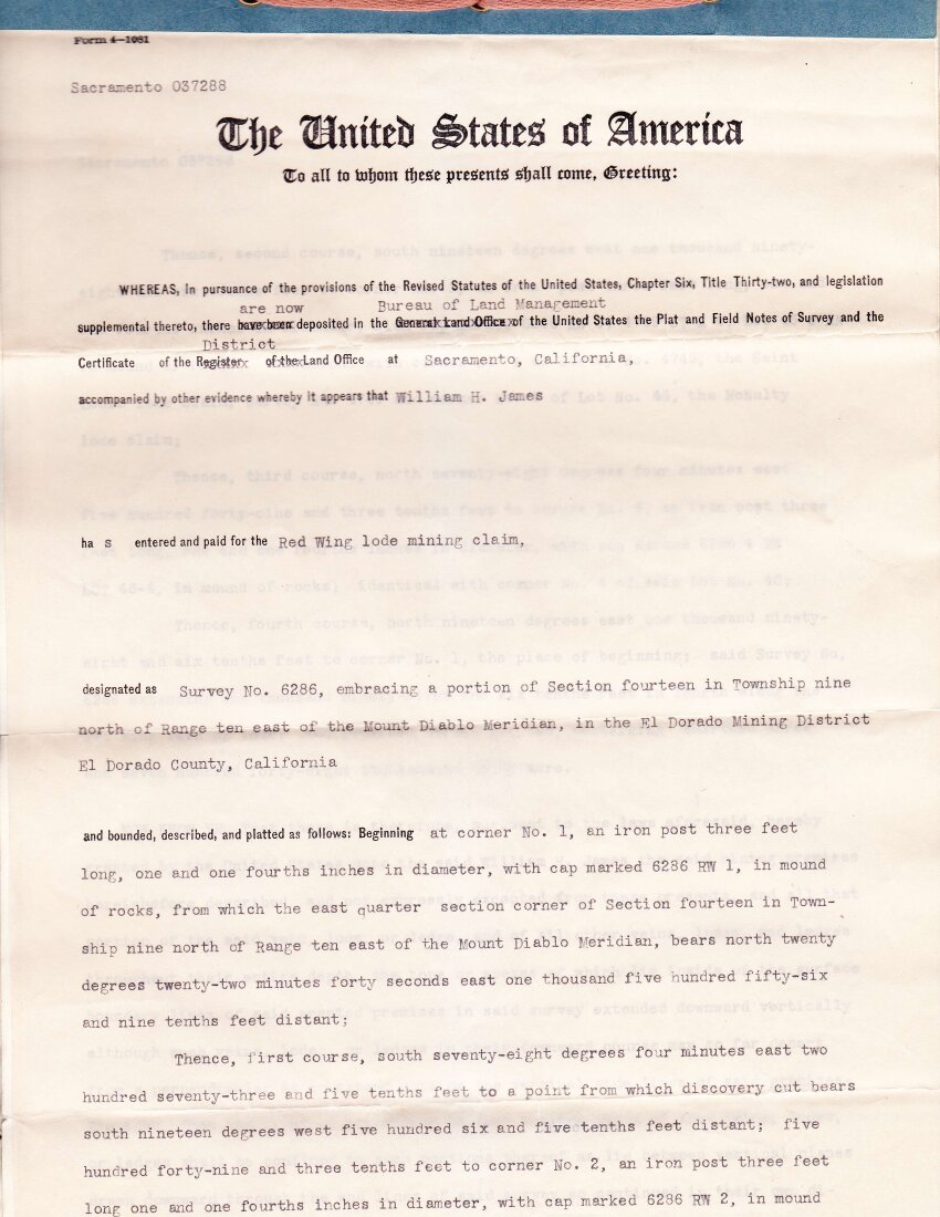
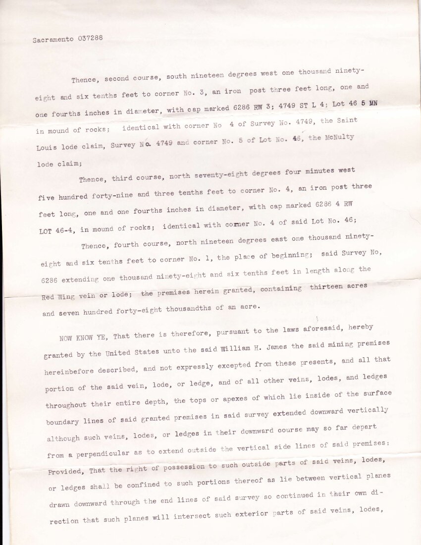
James filed for the patent in 1948. The surveyor walked the ground that August and drew up the survey. The General Land Office processed the paperwork through the spring of 1949. On March 31 of that year, the United States granted James the federal patent for U.S. Mineral Survey 6286 — 13.748 acres of lode ground, tracing the principal vein for 1,098.6 feet along the lode. He had held the claim for forty years.

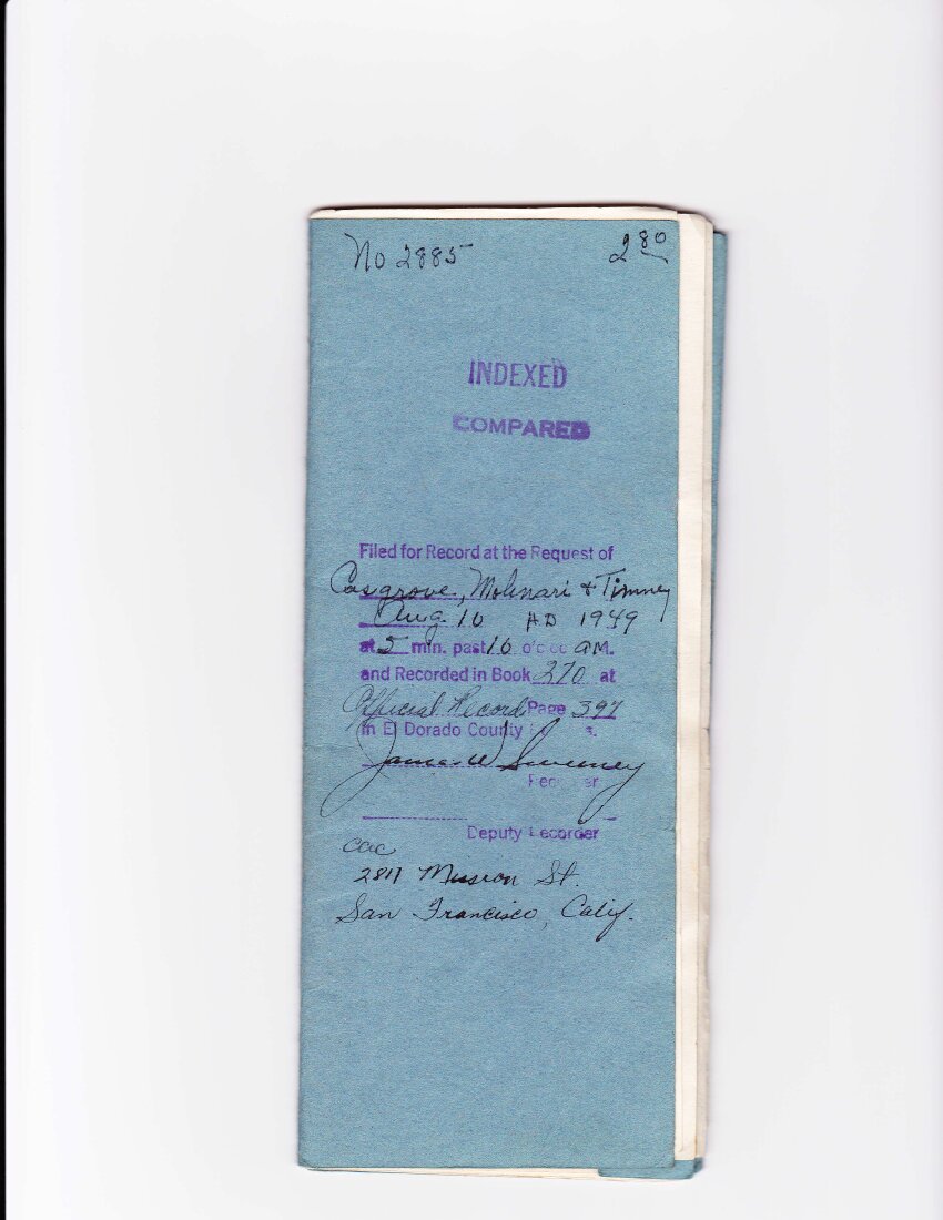
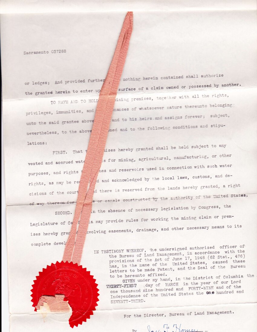
Four pages below. The recorder's filing cover, then three pages of patent text. The final page carries the United States seal and the stamped wax.

Filing cover of the federal patent papers for U.S. Mineral Survey 6286.
Filing cover. Recorder's docket sheet for the federal patent.
Federal patent text, page 1, for U.S. Mineral Survey 6286.
Federal patent, page 1. United States of America — patent grant to W. H. James, March 31, 1949.
Federal patent text, page 2.
Federal patent, page 2. Survey particulars and lode description.
Federal patent final page with United States seal and stamped wax.
Federal patent, page 3 — with seal. The United States seal and stamped wax.
The plat — August 25, 1948

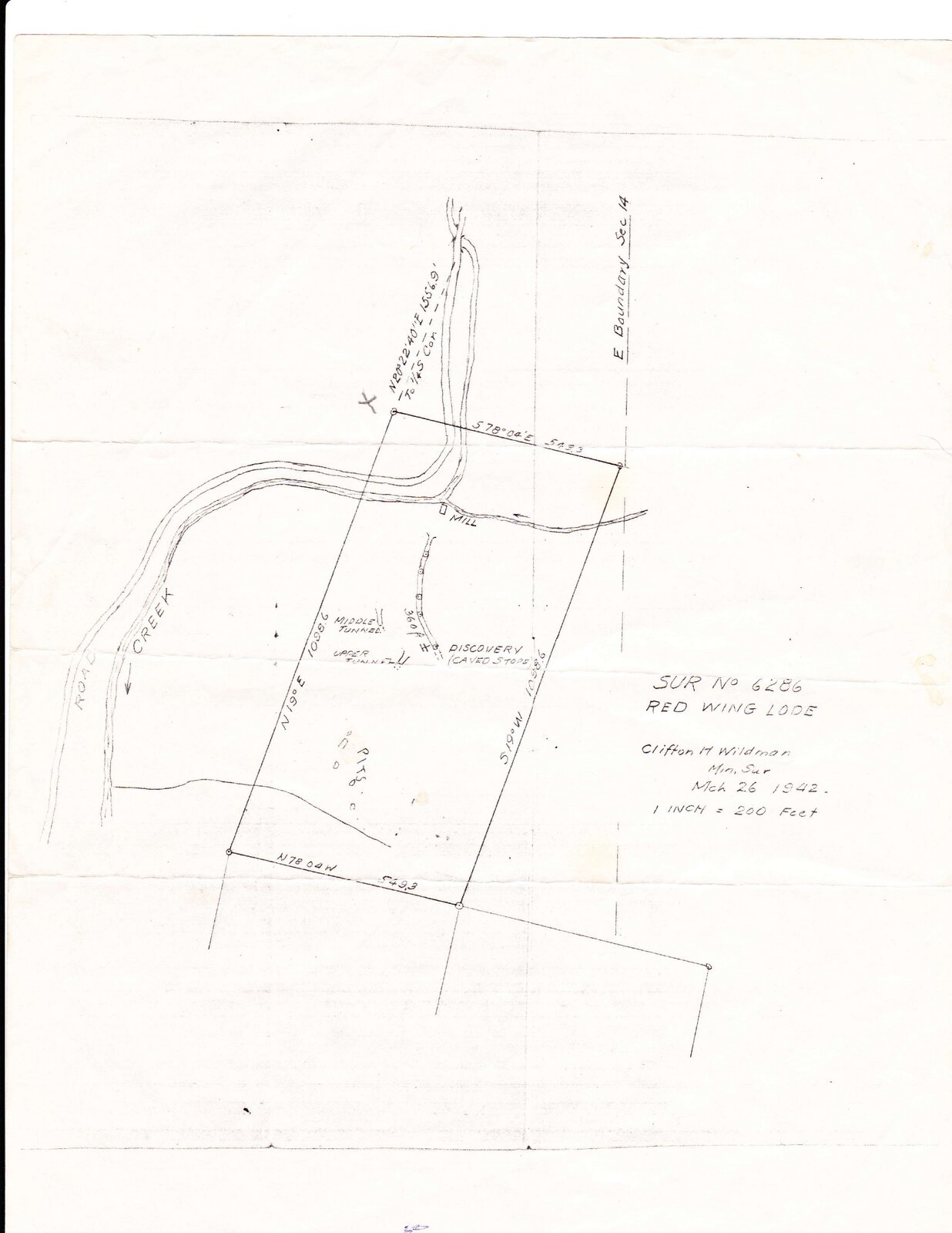
The surveyor's hand drawing of the property, prepared the summer before the patent issued. One inch to two hundred feet. The Red Wing claim outlined at center; Bidstrup, Climax, and Bismark penciled in on the adjacent ground.

Hand-drawn 1948 surveyor's plat of U.S. Mineral Survey 6286, Red Wing Lode.
Working sketch, U.S. Mineral Survey 6286, Red Wing Lode. Drawn August 25, 1948.
The 1980s and after

After James died, his widow Kathryne James kept the property. In 1983, Don's father, Gary, bought it from her. Gary worked it with Don and Don's brother for a few years. Don's brother-in-law Boyd helped at the tail end. They drove a short crosscut from the middle adit looking for better ore. They cleaned out the old drifts and pushed against the rock the early operators had left.

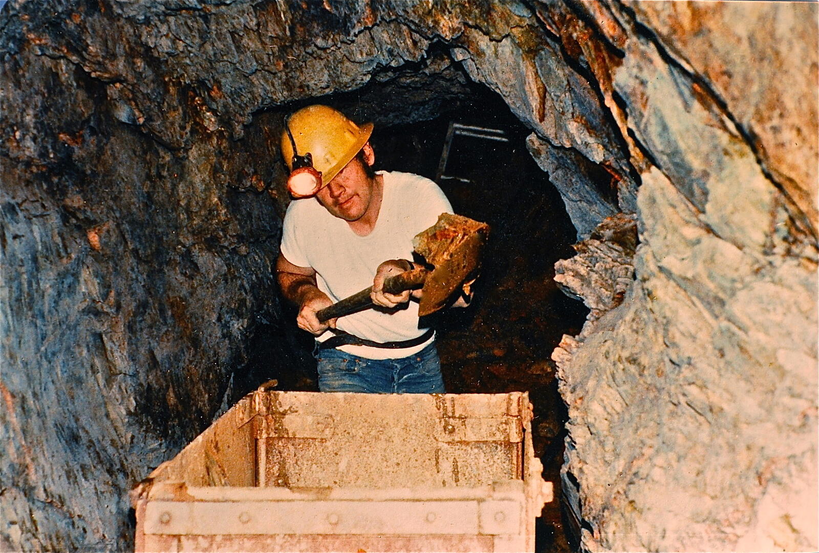
Gary, Don's father, in the workings of the Red Wing in the 1980s, wearing a yellow hard hat with a headlamp, shoveling ore from the working face into a metal ore cart.
Loading the cart. Gary in the workings, hard hat, headlamp, shovel.
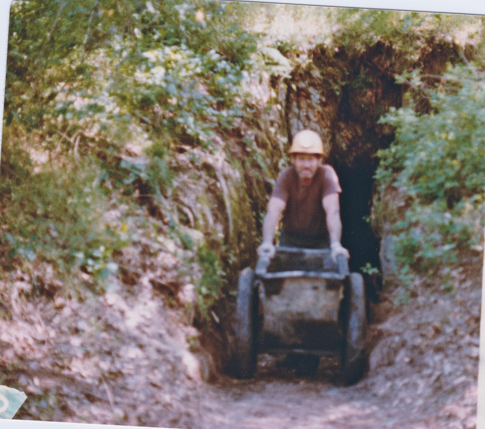
Gary pushing the loaded iron ore cart out of a wooden-framed portal entry at the Red Wing in the 1980s, red shirt, hard hat, gloves, hands on the rear of the cart.
Hauling it out. Gary pushing the loaded cart out of the portal.
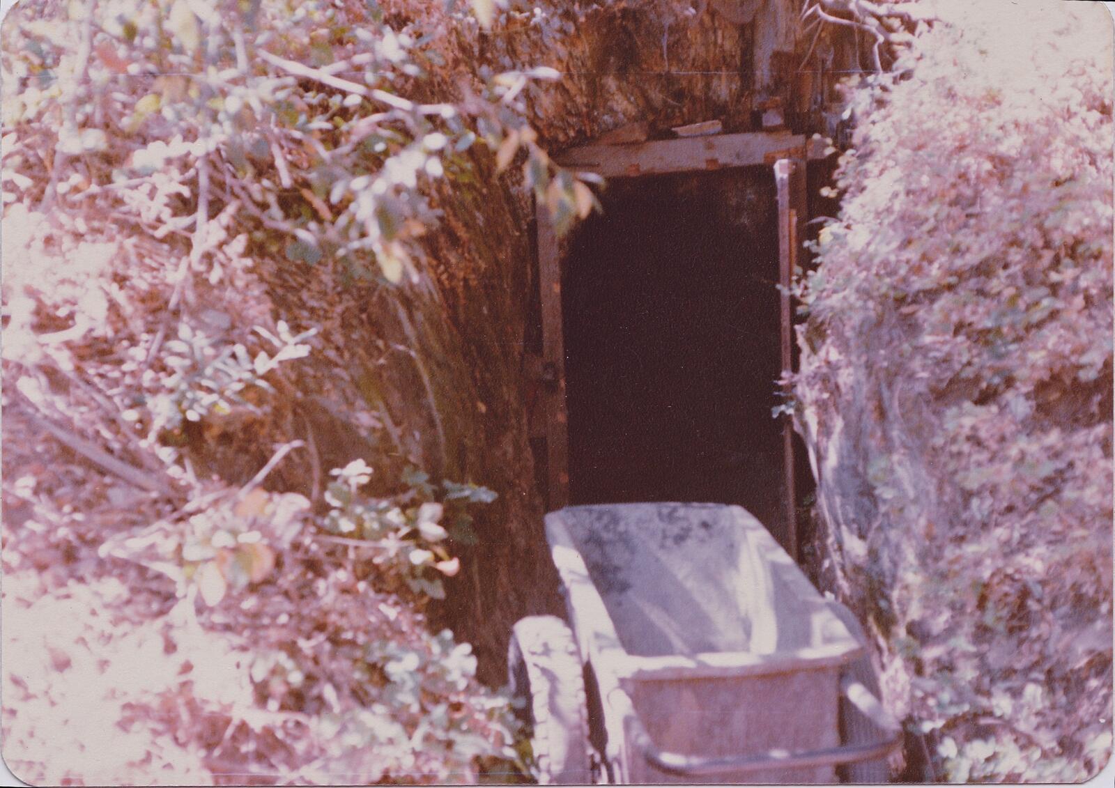
The iron ore cart sitting empty on rails outside a dark portal entry at the Red Wing in the 1980s, with vegetation crowding the trail on both sides.
The cart at the portal. Between hauls.
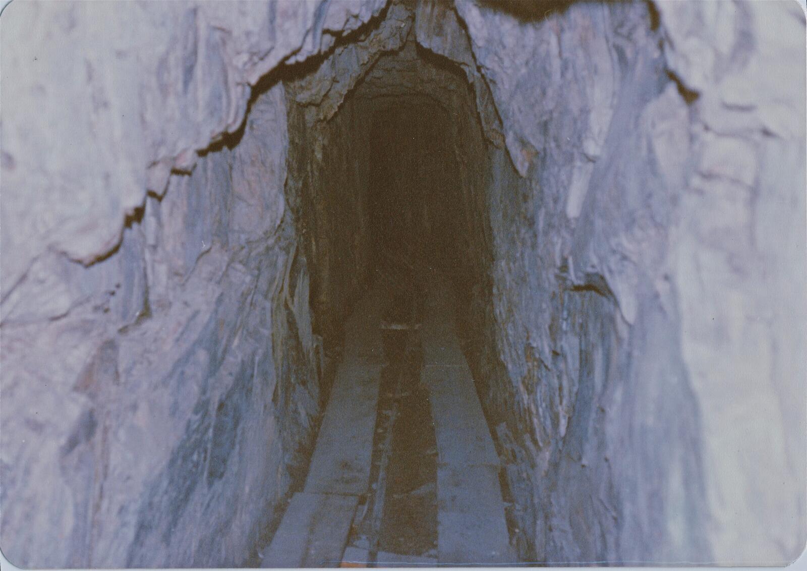
The interior of a narrow worked drift at the Red Wing in the 1980s, iron rails running down the floor, calcite-stained slate walls arching toward a low roof, receding into darkness.
The drift, from the inside. Rails on the floor, slate overhead.

We wouldn't have dug all this out of here if it wasn't quartz everywhere.

Don, recalling the 1980s work — from a walk through the workings, 2026
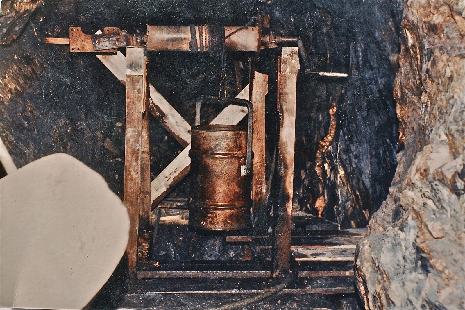
The wooden windlass and half-barrel bucket built above the stope in the Red Wing workings in the 1980s, used to lift ore out of the stope by hand-crank.
The windlass and bucket. Hand-cranked over the stope.
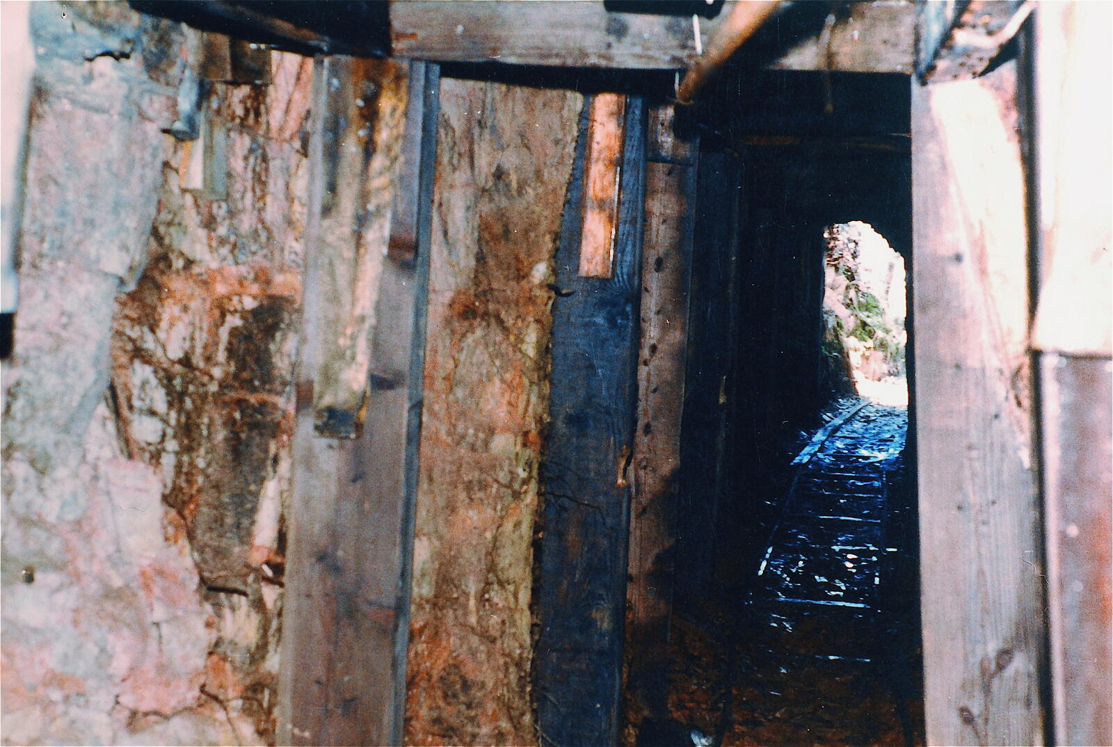
The interior of a worked drift in the Red Wing in the 1980s, heavily timbered with vertical wooden braces along the walls, leading to a daylit opening at the end.
A timbered drift. Iron-stained walls, doorway to daylight.

Lot of shovel. We'd throw it up. My dad would be down there and throw it up a little. Man, there's a lot of quartz down here.

In the old stope — from the same walk

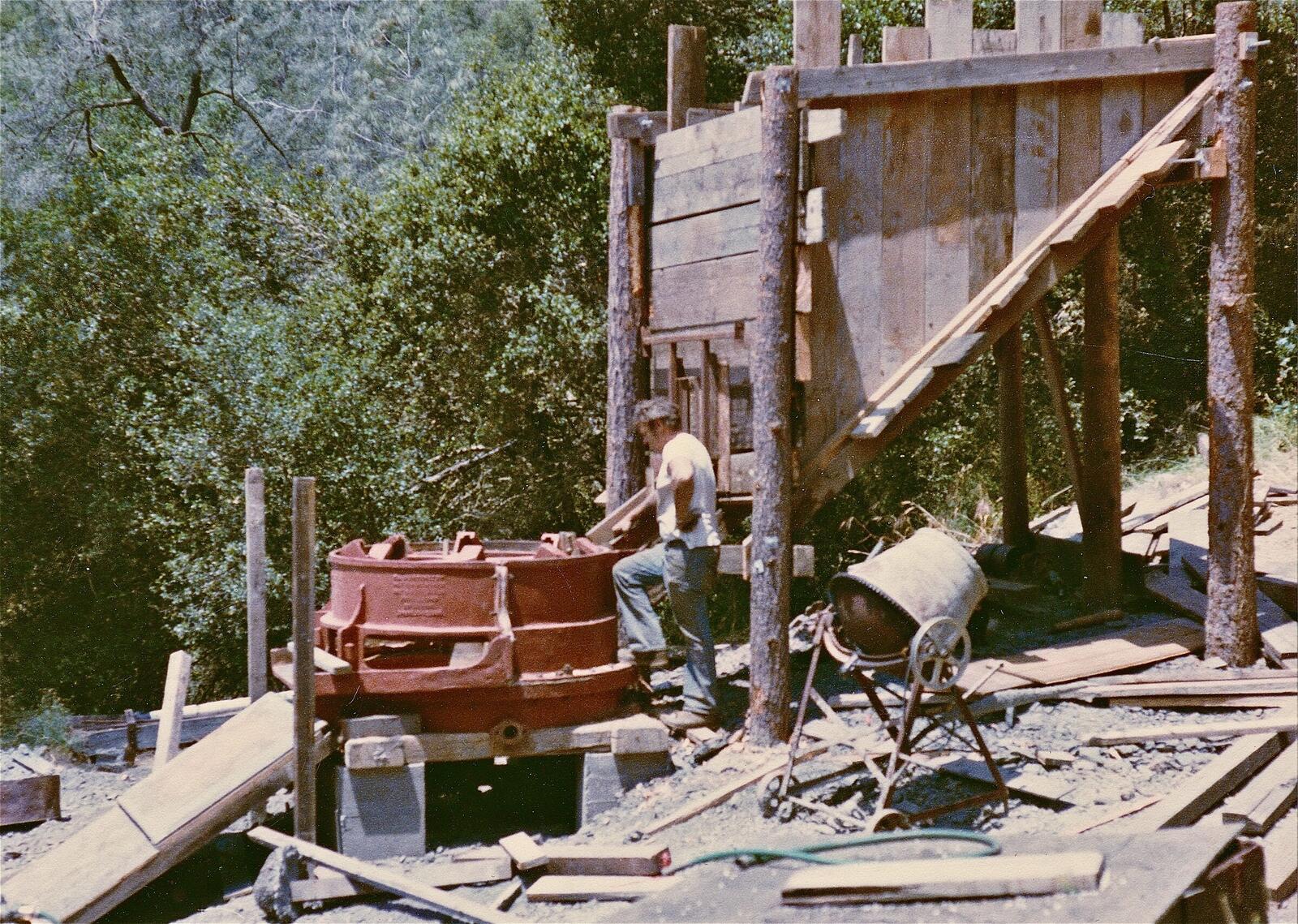
Above ground, the mill was running. The family ran a Huntington mill on the bench above the road, turning rock from the workings into concentrate.

Gary, Don's father, at the red Huntington mill drum at the Red Wing in the 1980s, with the wooden timber ore-bin framework above feeding into the mill.
Gary at the Huntington mill. Red drum, ore bin above feeding in.
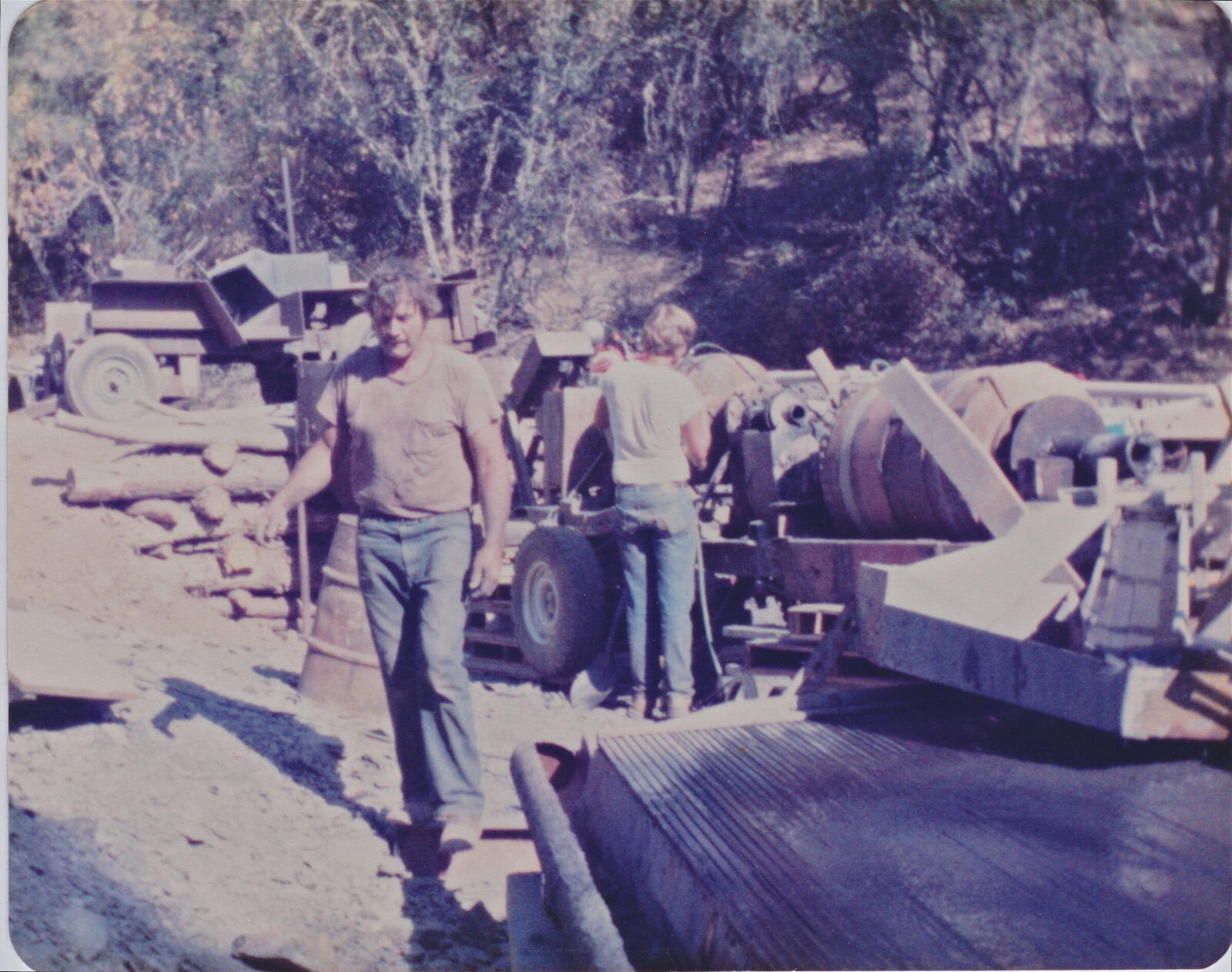
The Red Wing mill site in operation in the 1980s. Gary, Don's father, walks past the mill equipment; Don as a kid is at the mill drum behind him. Lumber stacked, rocker box in the foreground, oaks behind.
The mill site at work. Gary in the foreground, Don as a kid behind.

Gold was three hundred dollars an ounce. They couldn't make it pay. Don has said it was easier to make money working in the trades. The major work eased off but Don kept the property active. They left behind table concentrates they thought might be worth running someday.

Don worked the property in fits and starts over the years that followed.

In the press

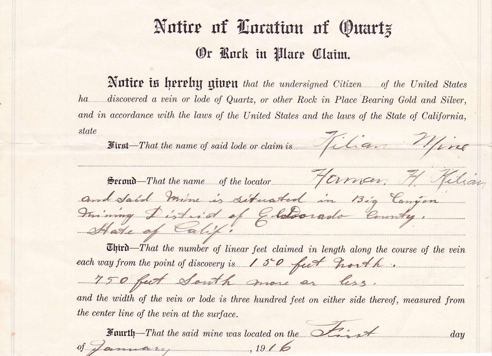
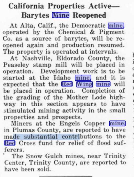
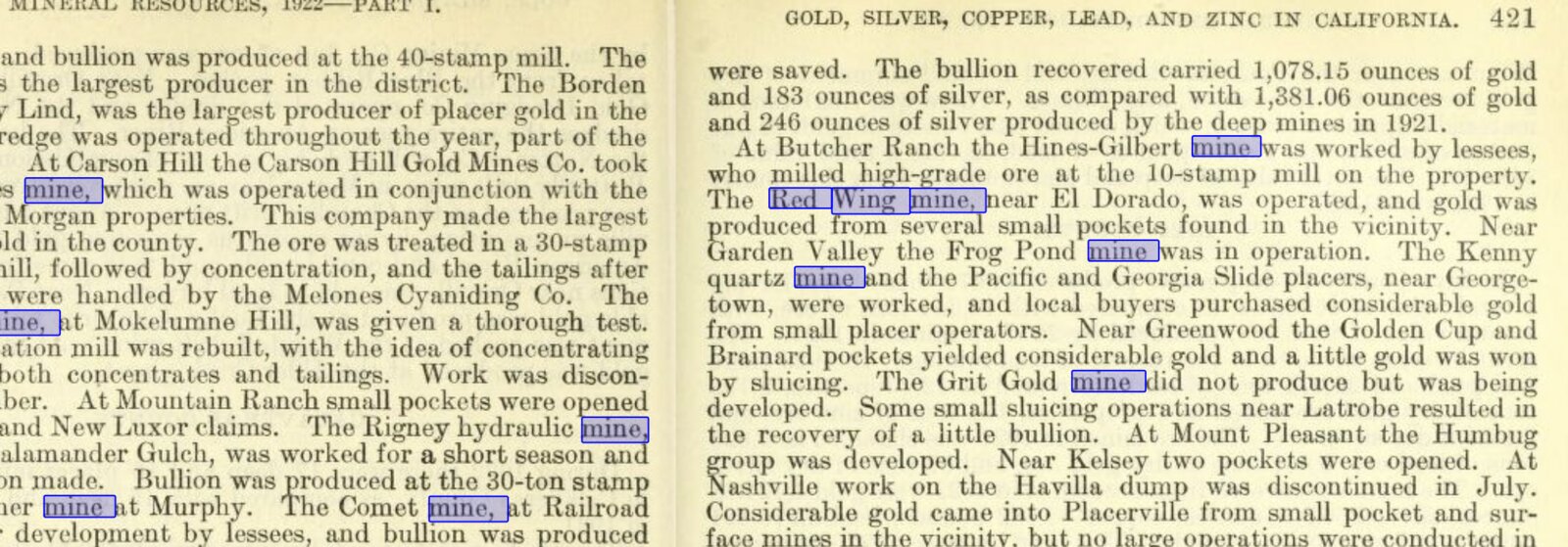
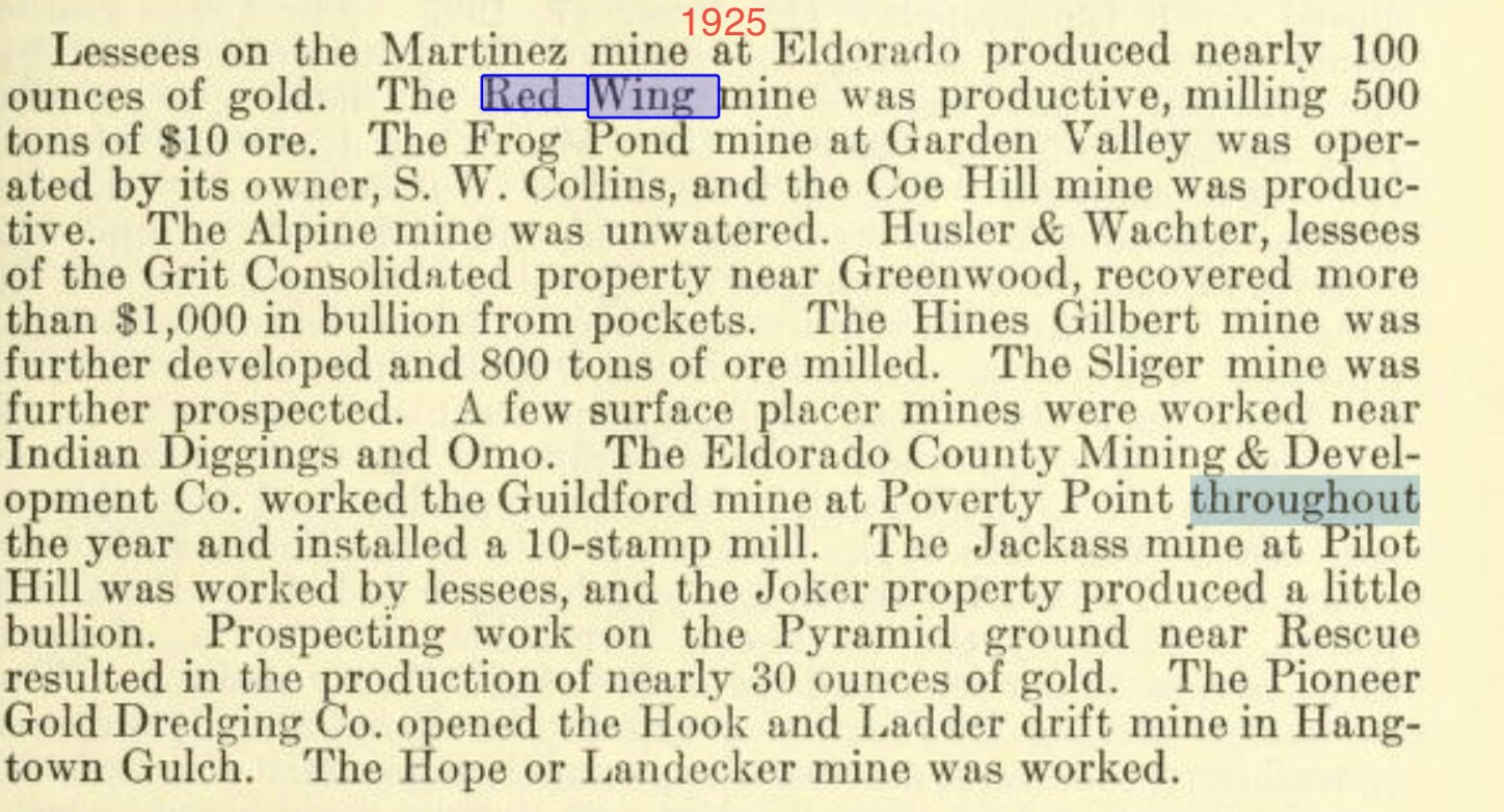
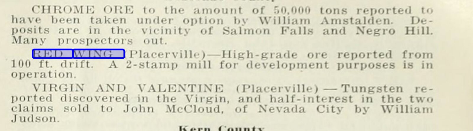
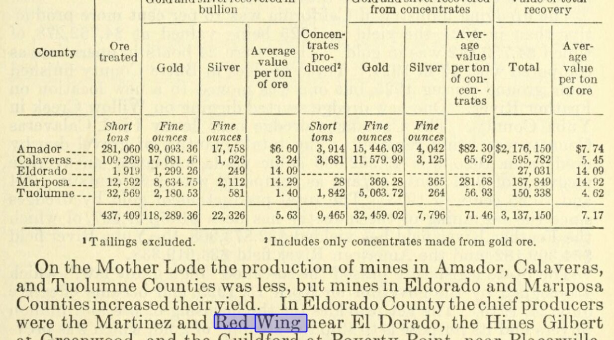
The Red Wing surfaces in the local and state record across the 1910s and 1920s in short items. A 1916 location notice from a neighboring filer in the same mining district. Reopening notices. State mining-bureau reports listing the property milling five hundred tons of ten-dollar ore in 1925. A high-grade notice from the 100-foot drift with a two-stamp mill running for development purposes.

The neighbors in the press

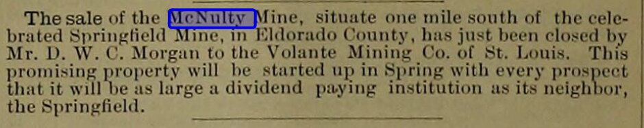
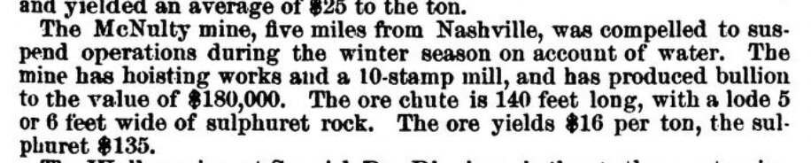
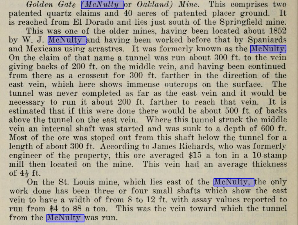
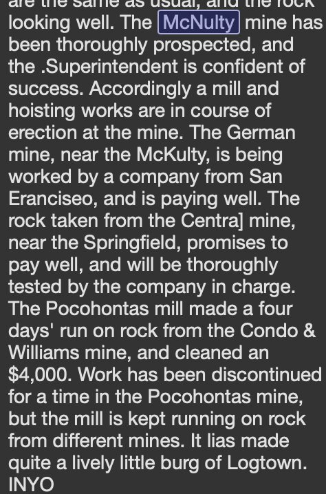
The Red Wing's nearest neighbor in the historical press is the McNulty Mine, a short way south along the same ridge. Period clippings from the McNulty's working years describe the surrounding country. Logtown is called a “lively little burg.” A thousand placer miners had been at work in the ravine in earlier years. A half dozen quartz mills were running on the ridge above. The McNulty itself had been worked under the name Volante in the 1880s by the Volante Mining Company of St. Louis.